
Forest, Nature and Environment Aceh (HAkA)
The challenge and the organization
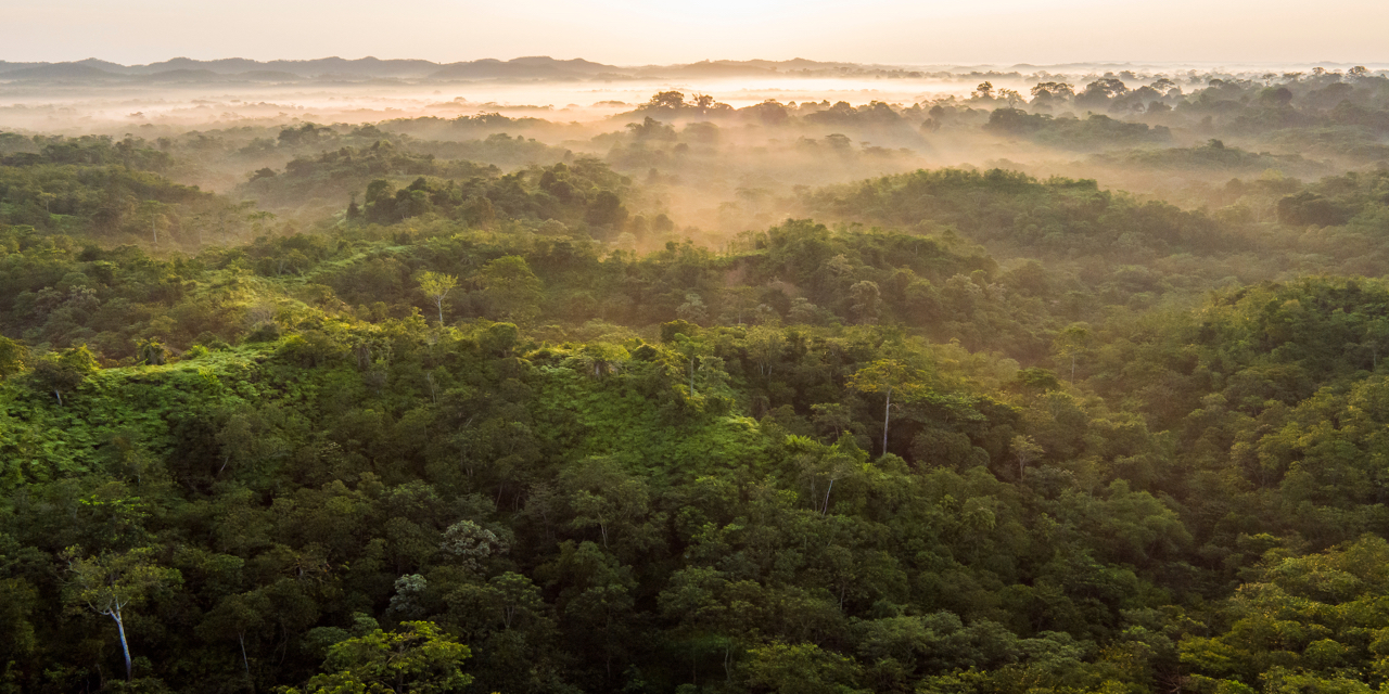
The last place on earth where orangutans, rhinos, elephants and tigers coexist in the wild, the Leuser Ecosystem in the Aceh and North Sumatra provinces of Indonesia is one of the richest expanses of tropical forest found in Southeast Asia. More than 2.6 million hectares of lowland rainforests, rich peat swamps, alpine meadows and montane forests make up the lush paradise. The Leuser Ecosystem is also home to an estimated 8,500 total plant species, more than 105 species of mammals and 382 bird species.
To protect this diverse natural region, a grass-roots non-profit organization called Forest, Nature and Environment Aceh (HAkA) was established in 2013 with a vision and mission to conserve the Leuser Ecosystem for a better, sustainable future for Aceh, Indonesia and the world. HAkA works closely with FKL (Leuser Conservation Forum), other local organizations and communities to reverse deforestation, prevent poaching as well as minimizing human and animal conflicts.
How they did it
After participating in the annual Geo for Good Summit in 2015, HAkA’s GIS Manager Agung Dwinurcahya began implementing Google’s mapping tools into HAkA’s projects and as a member of the Earth Outreach Trainer Network provided training to other local non-profits. He also was the first Indonesian partner to author and publish a Voyager story in July 2018. HAkA leveraged 3 mapping tools across their efforts in supporting their mission.
Research
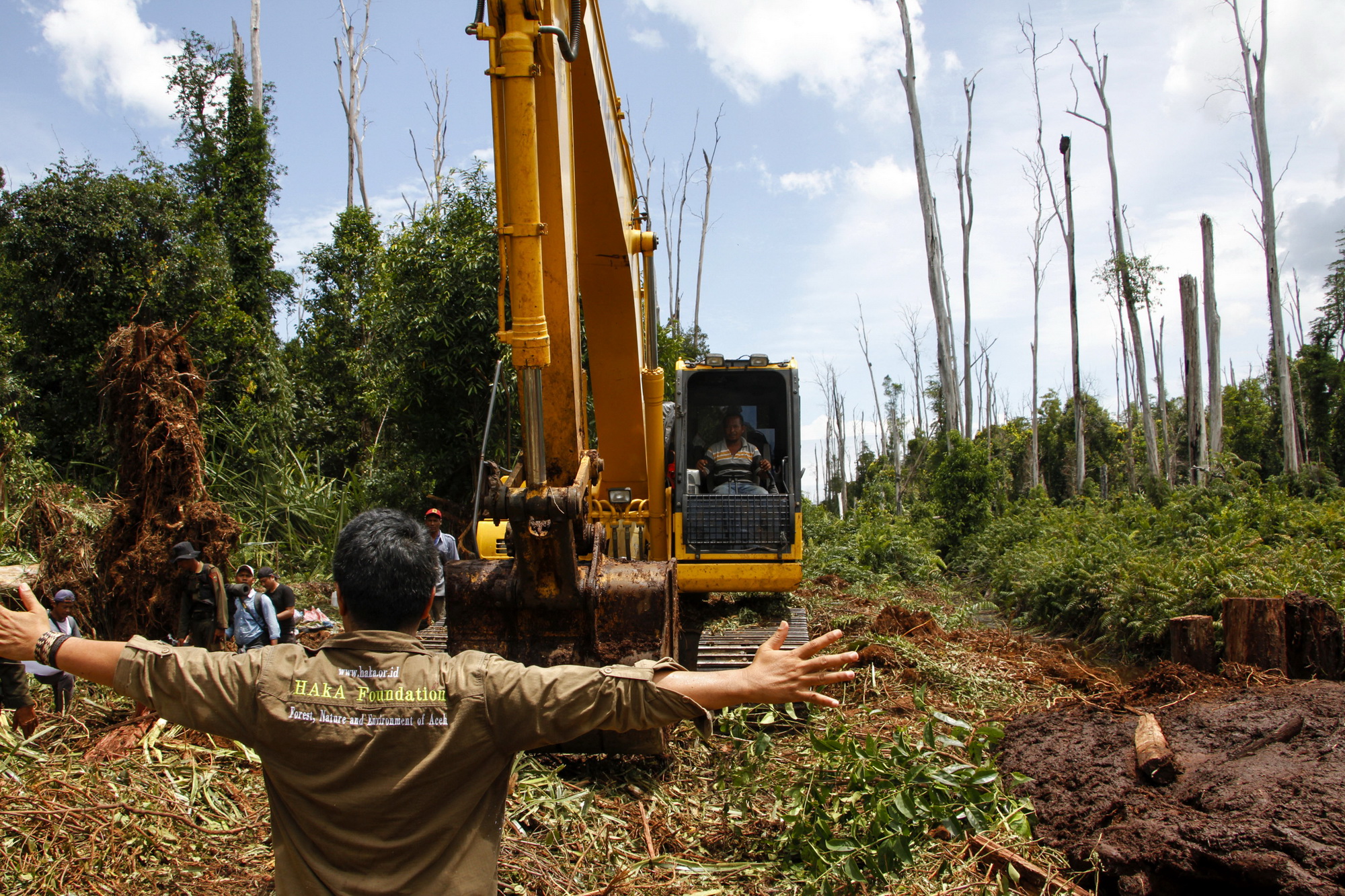
Using historical imagery in Google Earth Pro, HAkA could monitor forest areas from 2006 and saw high levels of damage to the forest. In 2017 the data showed that the level of deforestation in Aceh was around 17,000 hectares as well as an additional 15,000 hectares in 2018.
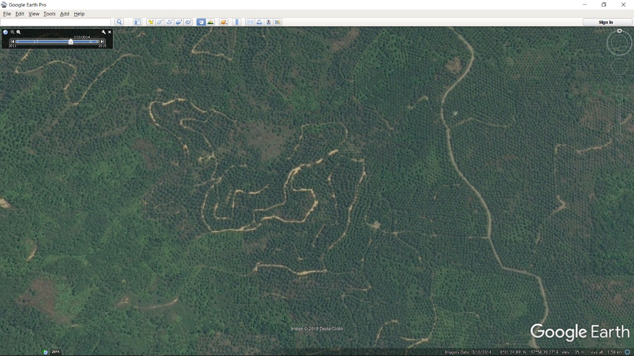
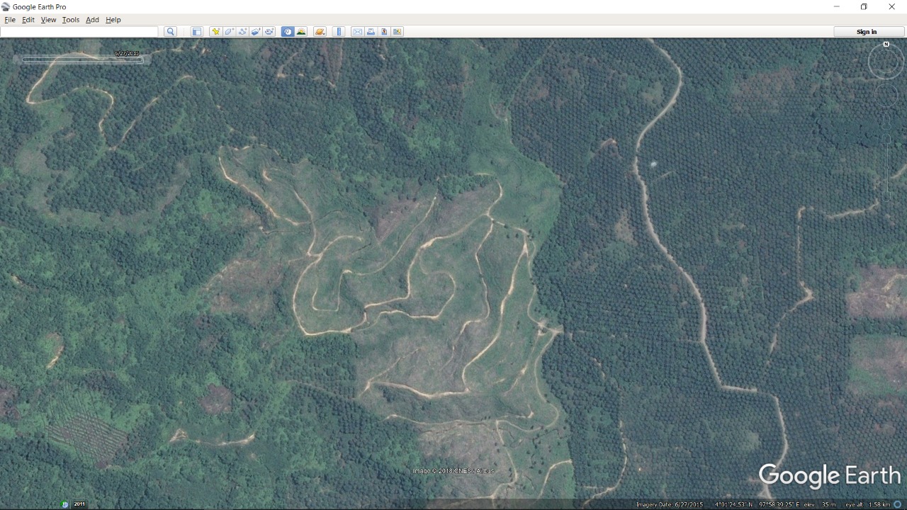
“With very high satellite resolution, we use Google Earth Pro to identify illegal oil palm plantations within protected areas (above) and their removal in progress (below) using historical imagery features.”
Data Visualization
Google My Maps visualizes data attained by the Leuser Conservation Forum (FKL) rangers and monitoring teams, who collect data on illegal forest activities such as poaching, deforestation, encroachment, and many others. The map data is valuable as it can be easily shared internally for evaluations, planning for future monitoring areas with external partners. Every hectare of forest lost in the Leuser Ecosystem creates a negative impact on the environment and the community, increasing risks of higher frequency flooding and landslides in various places.
Raising Awareness
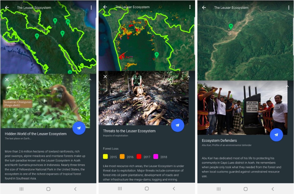
HAkA published “The Leuser Ecosystem” as Google Earth Voyager content, weaving the story across eight short chapters on top of Google Earth with rich photography and supporting YouTube videos. Publishing and sharing their story on Google Earth Web helped not only educate the public about the Leuser Ecosystem and threats currently facing Leuser, but also inspires everyone about the benefits of reforestation and saving this precious ecosystem. One of the earliest Google Earth Education Experts in Indonesia Steven Sutantro developed a lesson plan used to educate local students to raise awareness and deepen understanding of the Leuser Ecosystem.
Impact
Once the Voyager story launched, HAkA saw an increased public awareness of the Leuser Ecosystem as well as the importance of preserving it. The Indonesian government and other stakeholders have understood more about the Leuser Ecosystem and began to pay more attention to the issue. And we have seen changes in political actions that benefit the Leuser Ecosystem.